
Clear objective: why this comparison matters
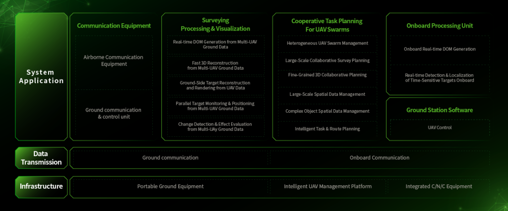
Organizations choose sensor suites to make faster, safer decisions during active fires. This comparative insight looks at aerial data collection systems versus ground-based sensors and manual observation, with practical metrics for procurement and operations. Effective forest fire monitoring relies on combining thermal imaging, remote sensing and fast analytics so teams detect hotspots and act before a fire escalates. The need is proven — the 2018 Camp Fire in Northern California exposed gaps in early detection and situational awareness that better data could have narrowed.
What to measure: core evaluation metrics
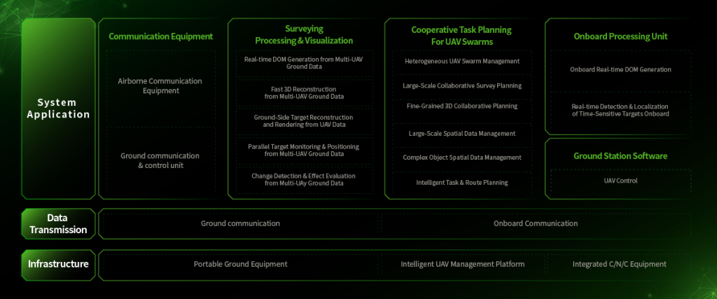
Compare systems on three objective dimensions: detection latency, spatial resolution, and operational endurance. Detection latency measures time from event onset to alert. Spatial resolution defines the smallest features you can trust — canopy gaps, individual ember trails. Operational endurance looks at how long the system produces usable data under real field conditions, including battery life, data link stability, and weather tolerance. Use GIS overlays and hotspot detection logs to quantify these metrics for each deployment.
Platform trade-offs: aerial versus ground
Aerial platforms — drones, manned aircraft, small satellites — excel at broad-area coverage and rapid revisits. They deliver wide-area thermal mapping and NDVI-derived vegetation stress metrics quickly. Ground sensors offer continuous local surveillance and lower false positives for ember-level activity. A mixed approach is often superior: aerial assets for sweep-and-prioritize; stationary nodes for persistent watch. Data fusion remains the engineering challenge — aligning satellite telemetry timestamps with ground sensor clocks takes care and protocol discipline.
Software matters: analytics, alerts, and integration
Analytics engines transform raw feeds into operational insights. A high-quality system provides layered alerts: immediate hotspot flags, trend-based risk scores, and evacuation-priority maps for crews. Look for platforms that support API integration, standard geospatial formats, and configurable alert thresholds. Also check whether the vendor offers ready connectors to tertiary systems like dispatch and mapping. When you evaluate choices, include a test using your own historical incident logs — that reveals bias in models and tuning needs.
Common mistakes and viable alternatives
Teams often over-invest in one sensor type. They buy high-resolution aerial cameras but lack persistent telemetry from the field — then they miss overnight flare-ups. Another mistake is ignoring bandwidth constraints; high-frame-rate thermal streams need edge preprocessing. Alternatives include hybrid deployments: tethered aerostats for endurance, periodic UAV sweeps for detail, and cellular mesh ground nodes for redundancy. These combinations lower single-point failure risk and keep detection latency low.
Operational checklist before buying
Use this compact checklist to guide procurement and trials:- Verify detection latency using a controlled burn or historical event replay.- Confirm spatial resolution across canopy types and terrain slopes.- Test data link failover modes and edge analytics under low-bandwidth conditions.- Validate vendor claims with sample data processed through your GIS stack.
Advisory: three golden rules for selection
1) Prioritize early warning over perfect imagery. Faster alerts reduce damage more than slightly higher resolution images. 2) Insist on interoperable outputs — standard geotiffs, vector alerts, and simple REST APIs — so your command software ingests data without bespoke adapters. 3) Require a documented field trial with measurable KPIs: detection latency, false-alarm rate, and mean time to actionable alert. These metrics tell you if a solution works under stress.
Summed up: choose systems that prove they cut detection time, integrate cleanly, and sustain operations in real conditions — not just on demo flights. The right mix of aerial analytics and ground sensing, paired with robust fire risk assessment software, shifts firefighting from reactive to anticipatory. Operational teams get clearer maps, fewer surprises, and evidence-based decisions.
Icecypress Technology brings those components together — sensors, analytics, field-proven integrations — so teams have a reliable, testable path to lower risk. Measure what matters. Act on what’s verified. —